Denver Union Station Update #47 By Rick Anstey|2016-12-17T10:14:15-07:00December 18, 2010| Read More 1
Denver Union Station Update #46 By Rick Anstey|2016-12-17T10:12:49-07:00December 17, 2010| Read More 14
Union Station Tour January 15, 2011 By Ken Schroeppel|2018-03-25T07:24:41-06:00December 16, 2010| Read More 3
Denver Bond Projects at DenverUrbanism By Ken Schroeppel|2018-03-25T07:30:05-06:00December 16, 2010| Read More Comments Off on Denver Bond Projects at DenverUrbanism
Hotel & Hospitality Center Update #2 By Ken Schroeppel|2018-03-24T17:26:59-06:00December 16, 2010| Read More 11
Denver Union Station Update #45 By Rick Anstey|2016-12-17T10:10:55-07:00December 8, 2010| Read More 5
ULI – Recharging Colorado on December 9 By Ken Schroeppel|2018-03-25T07:27:13-06:00December 6, 2010| Read More 1
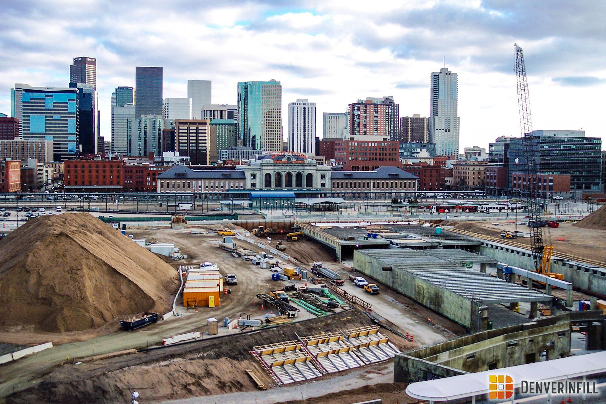
Union Station Tour December 4, 2010 By Ken Schroeppel|2018-03-25T07:23:46-06:00December 2, 2010| Read More 2
MSU Student Success Update #2 By Ken Schroeppel|2018-03-25T07:36:42-06:00December 1, 2010| Read More 4