

Back in April, we announced a new three-dimensional feature that provides us with a better visual of all the infill going in around Central Denver. Here is a short description from our announcement post:
Thanks to Google Earth and the new way they’re rendering buildings in three dimensions, and thanks in particular to the newest member of the DenverInfill team, Ryan Keeney—starting today we will periodically feature a collection of views of the Downtown Denver and Cherry Creek skylines with the massing of buildings, proposed or under construction, added in.
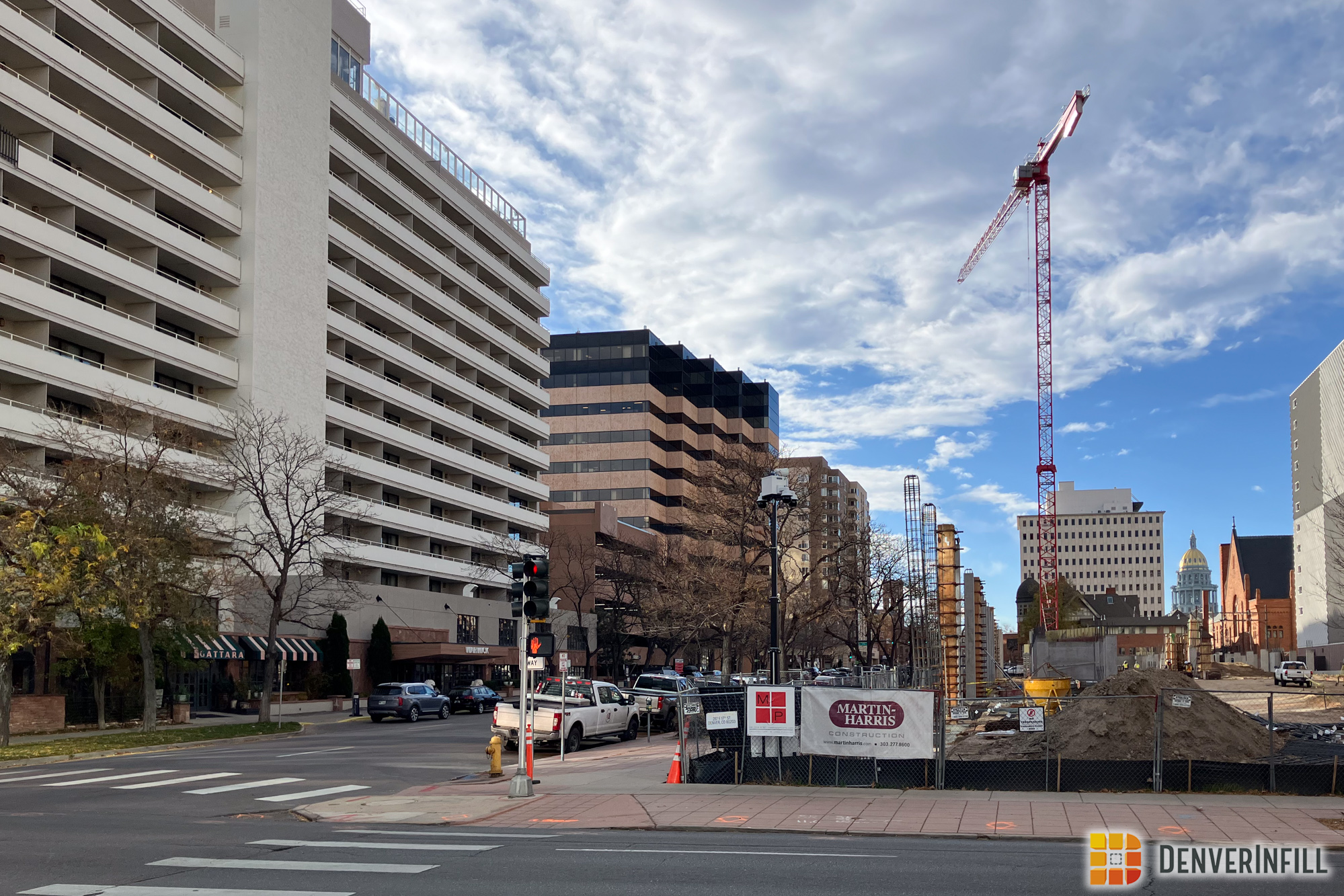
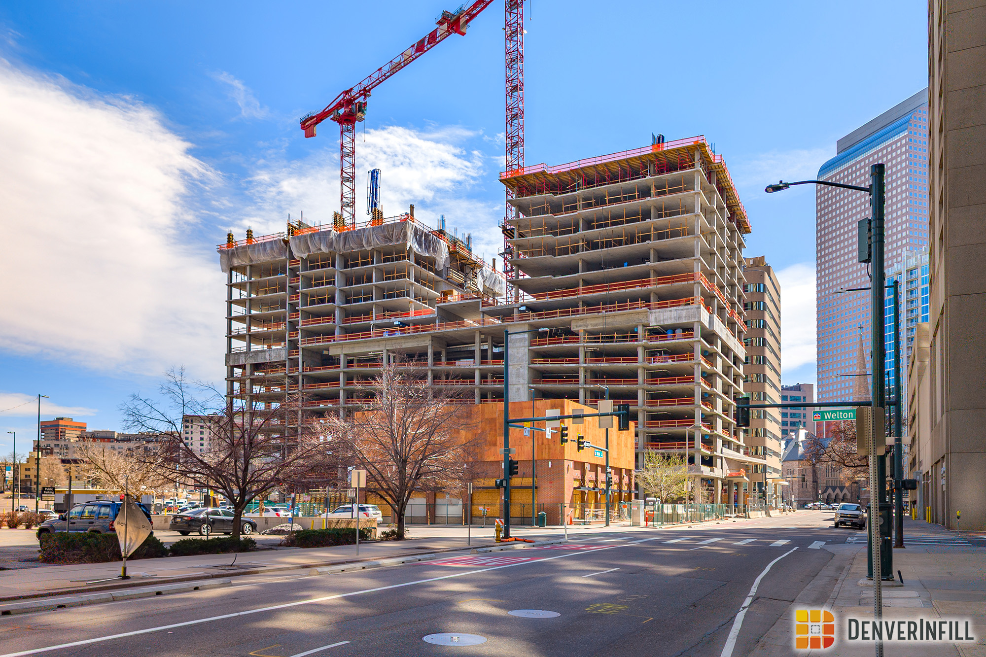
With the Downtown Denver Non-Residential and Residential project posts back in late June, it’s fitting to revisit the 3D future skyline.
Our first post featured the 3D skyline from a higher elevation overview perspective. Since there are many perspectives and elevations to share, we are going to explore the future skyline mostly from a lower elevation in this post. Let’s get to it! Make sure you click each image to embiggen.
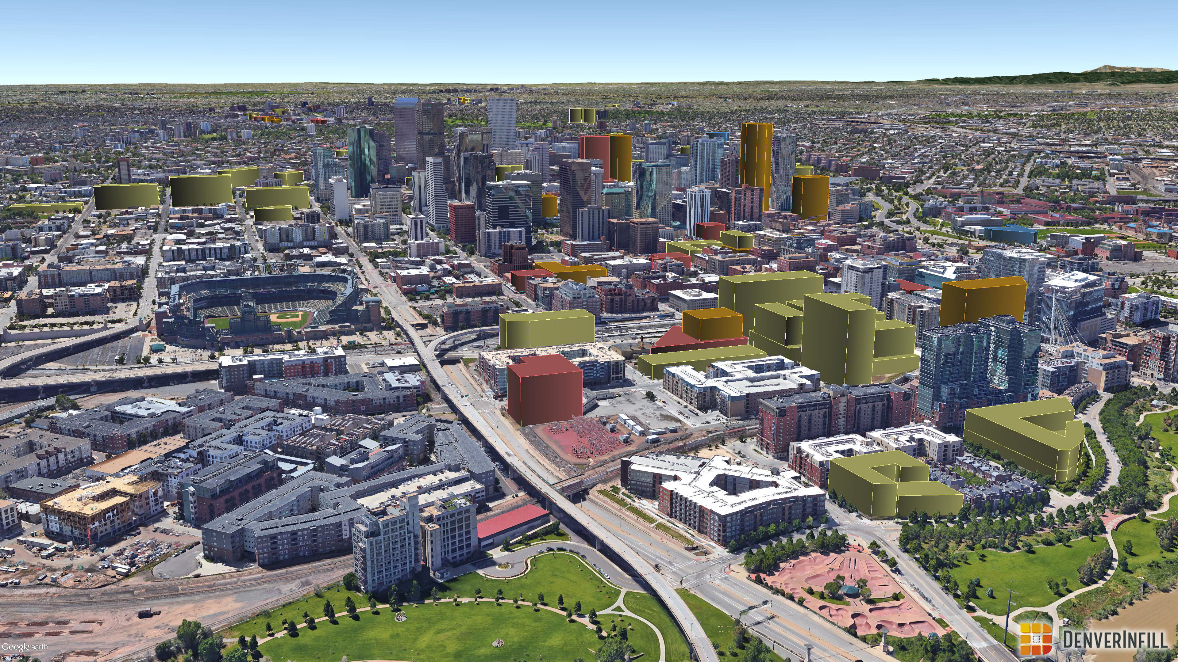
Downtown Denver looking north:

Downtown Denver looking south:

Downtown Denver looking east:

Downtown Denver looking northeast:

Downtown Denver looking southeast:
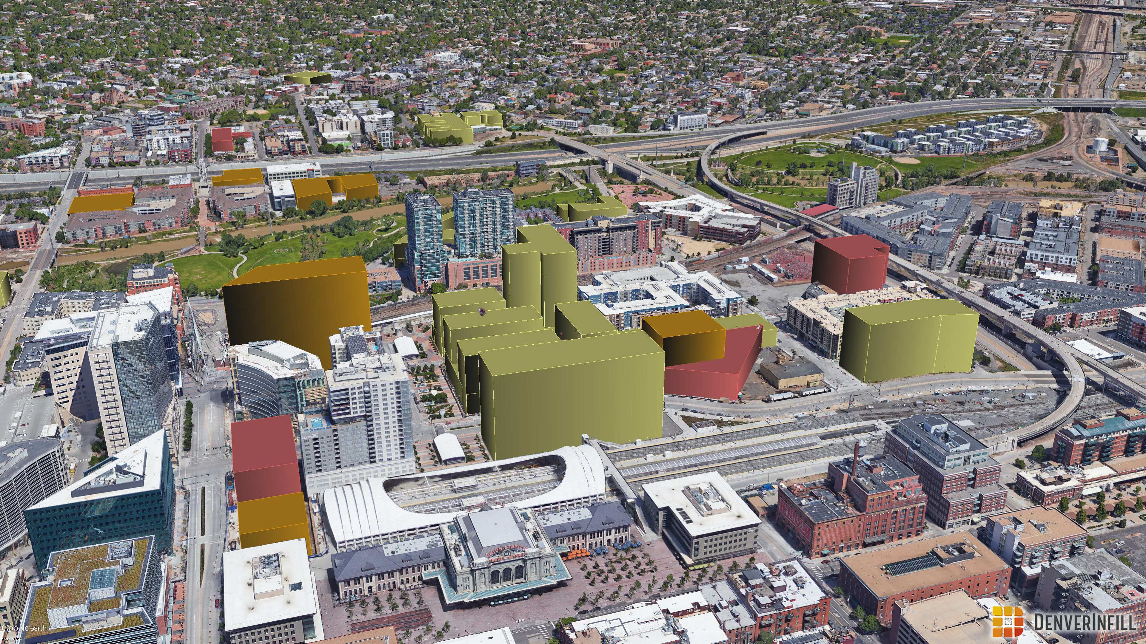
Denver Union Station up close:
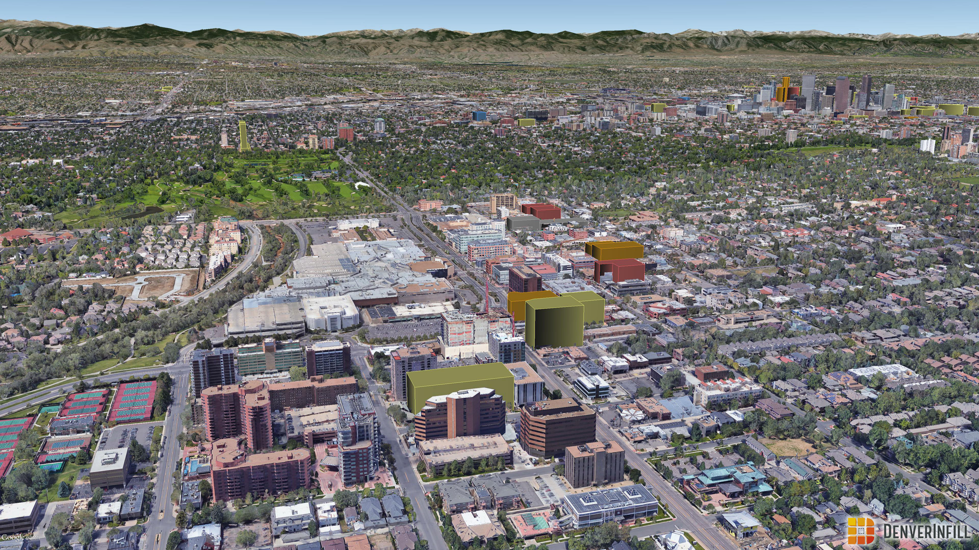
Cherry Creek looking west:
Central Denver high-level overview from River North to Cherry Creek:

It is truly amazing how many projects are proposed and under construction around Central Denver. A huge thank you Ryan Keeney for keeping these models up to date so we can visualize all of this infill!


Awesome stuff. Block 162 really makes a huge difference, hope it comes to fruition.
First off, I love these! Thanks for doing another one. Are you guys able to save your camera angles? I’d like to be able to do a direct comparison the next time you do an update. Also, could you make the massing models slightly transparent? Some of these building already have in-construction 3D models, so I’d like to be able to see a hint of those.
PS: Don’t forget to add this update to https://denverinfill.com/3d-future-skyline.
Thanks for the reminder to add this to our page!
As far as the camera angles, I didn’t think to jot down the coordinates, but I will keep that in mind next time.
As far as the transparency, I’m not sure. I’ll find out and see if we want to do that! 🙂
You guys missed the 2560 Welton project in the ‘looking south’ rendering.
Oops, my bad. It must have slipped through for a long time though because it wasn’t in our April 3D debut either! Thanks for letting us know.
Is there any significance to the color of the proposed buildings or are the color variations simply an artistic choice?
Please see the “About the 3D Future Skyline” page on the right sidebar
https://denverinfill.com/about-the-3d-future-skyline
Agreed with the other Dan above – Block 162 will make an AWESOME impact if it comes through as planned; let’s keep our fingers crossed.
I agree with both Dans. 15th street should be seeing some much needed love soon,