

After a full year, it’s that time again to re-visit our 3D Future Skyline. With many more developments on the board over the past year, there are a significant number of changes to our future skyline update. To revisit our previous posts for this special feature, head on over to the following link: 3D Future Skyline Post Archive.
A huge thank you to Ryan Keeney for the images and keeping the model up to date!
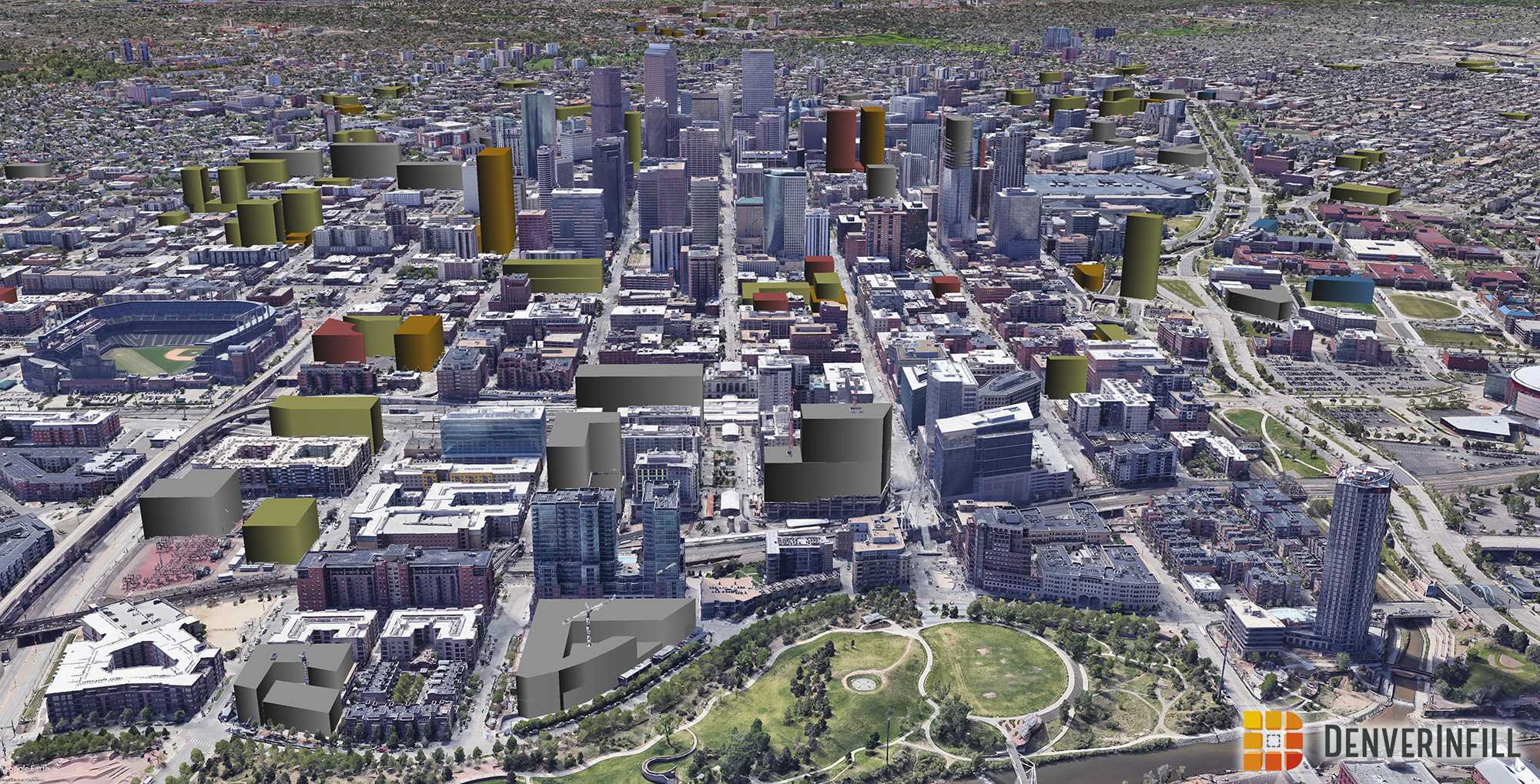
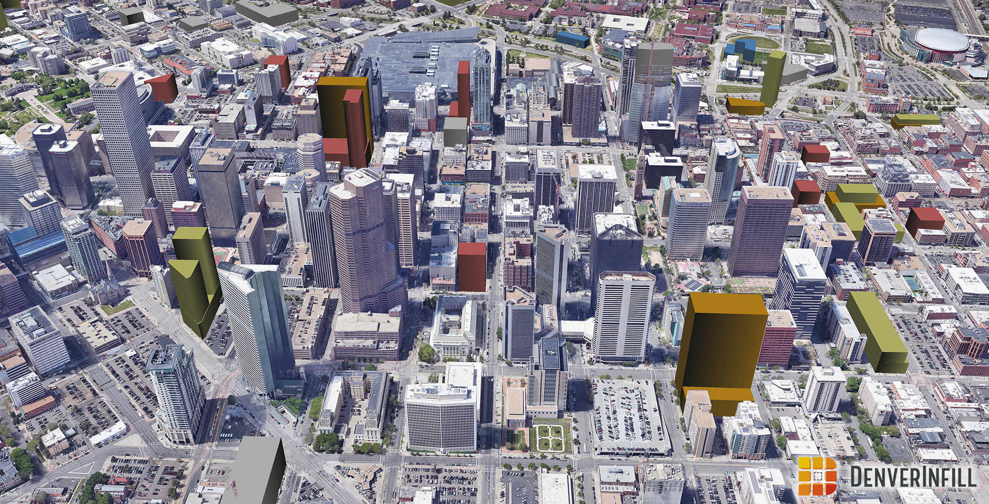
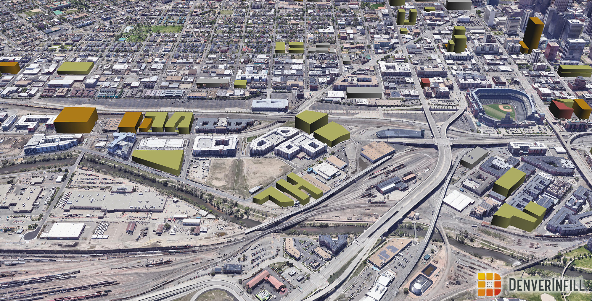
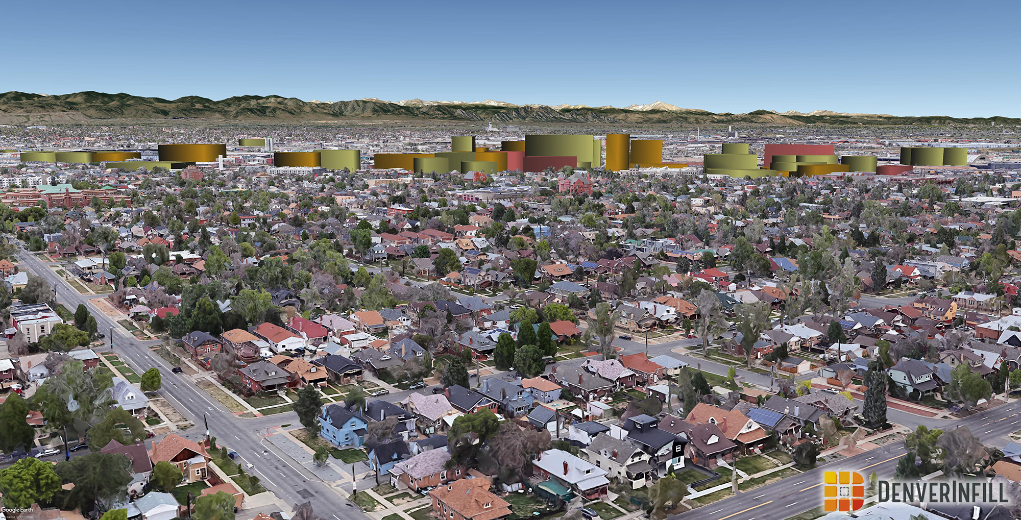
As a reminder, the buildings have been color-coded to match our DenverInfill Project Map, where yellow is residential, orange is office, red is hotel, and blue is civic/other. Mixed-use is indicated by a combination of these colors. Completed buildings, for which Google has not yet added their own models, are colored gray.
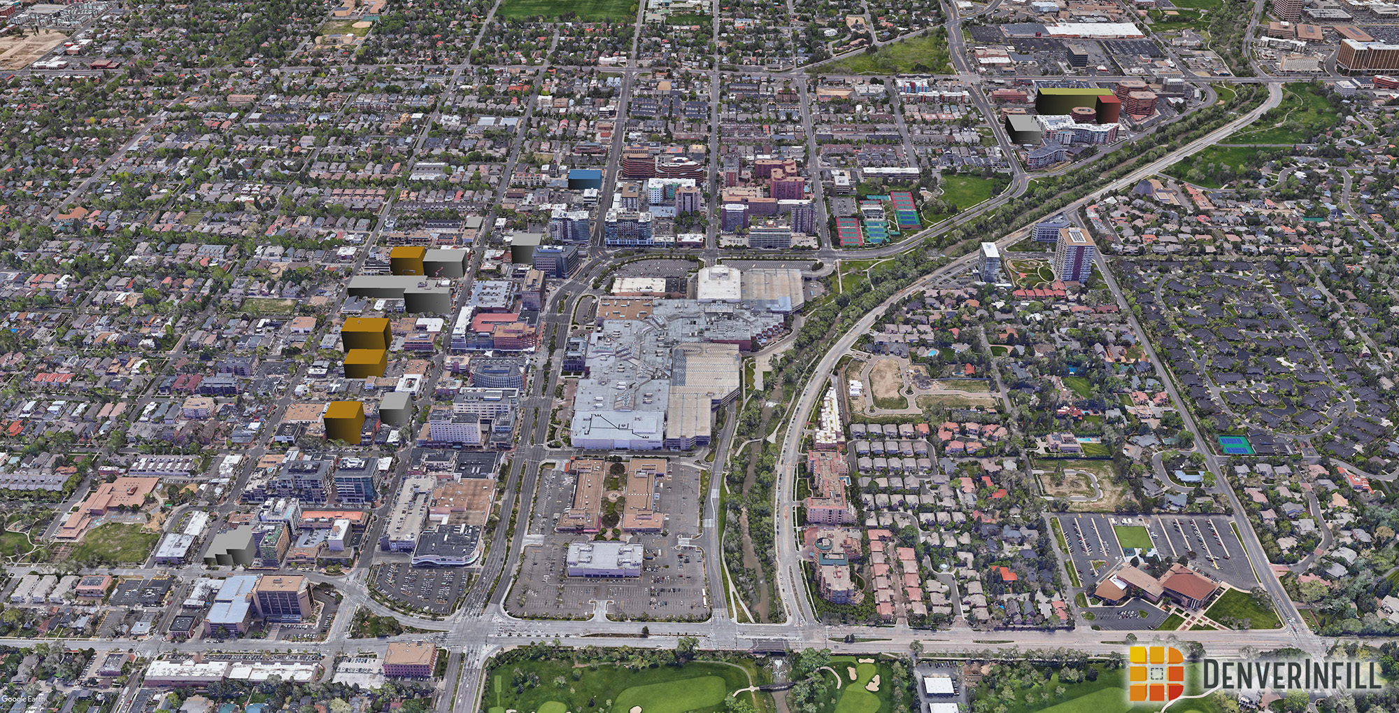
Let’s begin with the south and east neighborhoods: Baker, Speer, and Cherry Creek. As you can see, Cherry Creek keeps going through a significant transformation with many new developments.
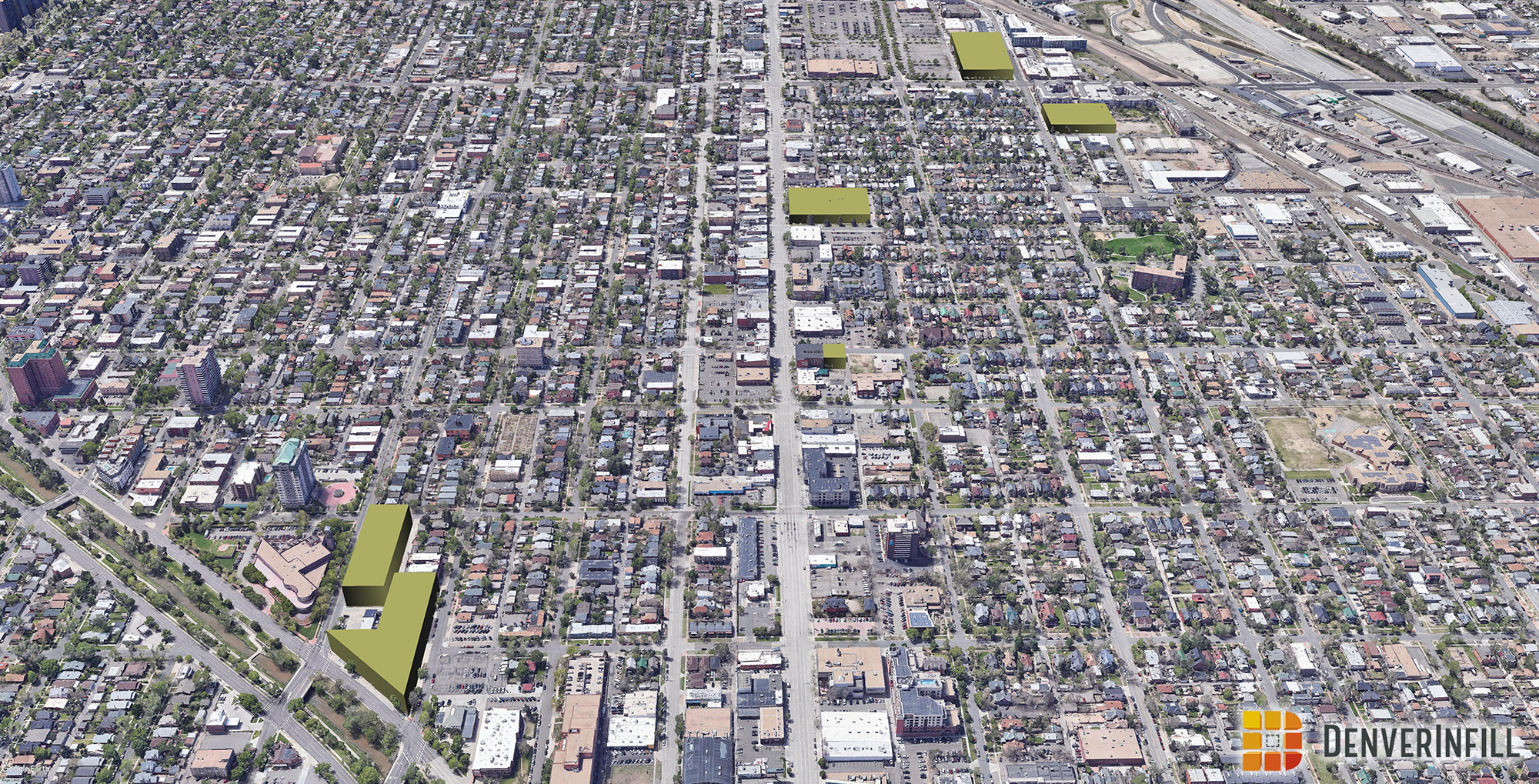
Next up, here is the Golden Triangle and La Alma/Lincoln Park. The Golden Triangle is seeing an uptick in larger development which will help fill in all of the surface parking lots still scattered throughout the neighborhood.


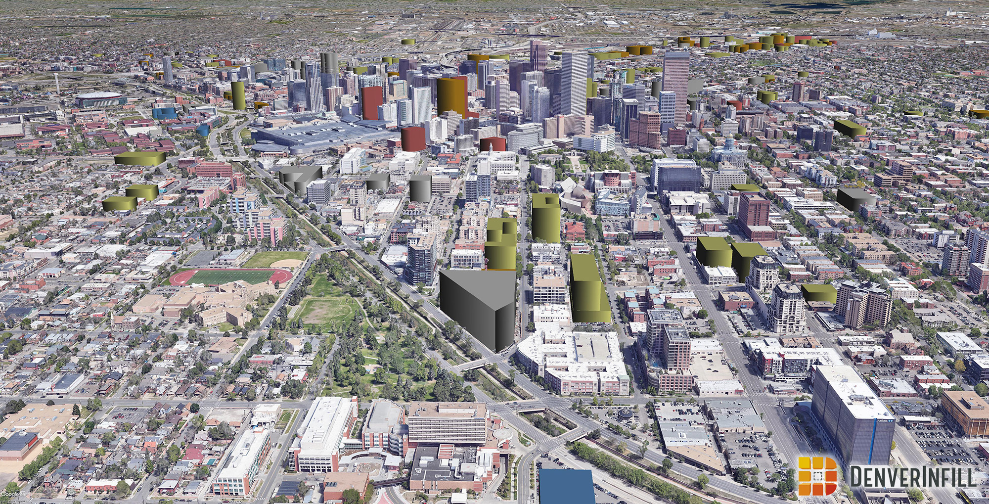
Central Downtown is continually seeing taller development with Arapahoe Square adding multiple 20+ story proposals. This will add a good amount of height and density directly north of Central Downtown.

Uptown, Lower Highland, and Jefferson Park are continuing to see development with larger projects going up in Jefferson Park.


Even though DenverInfill hasn’t covered much of West Denver, it is also seeing an uptick in development, especially around West Colfax and Sloans Lake.


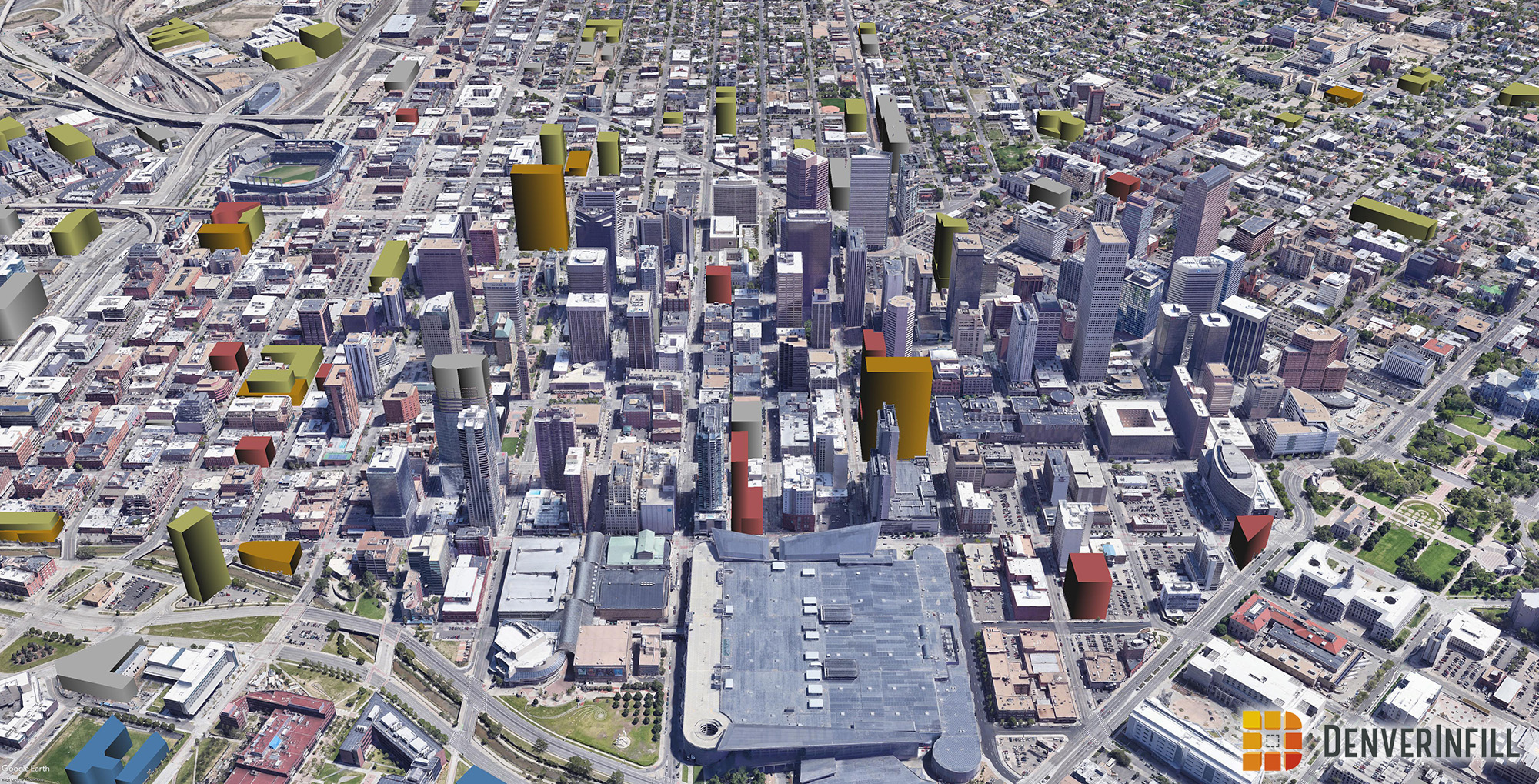
Let’s wrap up with River North which is exploding with development. The Denargo Market and Brighton Boulevard corridor keeps seeing a significant amount of development. However, that looks light when compared to what is proposed around the 38th and Blake commuter rail station. This development will create skyline of its own if a large portion of the proposed projects get built.


That’s a wrap! As you can see, the development boom in and around Downtown keeps on trekking with no slowdown in sight.


So much fun! Thank you denverinfill!
Great visualization as always! Thanks for keeping this up!
Great work! Do you know when if google earth will re scan Denver to show the new progression?
I’m not sure how often Google scans the areas that have 3D building coverage.
My favorite post of the year! Thanks for providing us all with this great content! The purposed density at 38th and Blake is truly remarkable. Should be exciting to see this neighborhood transform into a true mixed-use (24-hour) neighborhood.
How do you create these? I’m thinking Google Earth with some imported kmz files. If so, you wouldn’t by chance be willing to share those? 🙂
But those green spaces!!
/s
I’ve followed Denver Infill for a while now, never commented, but I am grateful for your work! Awesome post! I look forward to future posts!
Great post! Is there any way that I, as a user, would be able to map the projects to the related posts about the projects? There are definitely a few residential in the RiNo area that I am unaware of
This is great! Thank you for keeping us informed. I’m curious as to what the plan is for the building that was demolished on 16th Street Mall on the block where Target is.
I see you removed Two Tabor completely from the 3D images. Is it official that this latest proposal has, yet again, fallen victim to the two tabor development curse and is no more?
Why isn’t Westfield’s North Wynkoop project on here? https://www.northwynkoop.com/
We’ll add North Wynkoop in our next version. There are also some bigger developments around the Design District and Gates/Broadway we could add as well.
4180 Wynkoop is already completed. Seems like that one should at least be on your projects list.
thanks for this work, it’s a real contribution
i’d like to offer some ground truth — there are some projects in Baker that are not listed here nor here nor on your map that would make the scope of change in this area more clear:
* Alta Sobo Station, 500 W Cedar (nominal: 221 S Cherokee) — residential: 187 units, completed fall 2019
* 360 Acoma — residential: 171 units; site cleared, and minor utility work in progress; project has changed hands but current owners state it is still consistent with announced plans
* Broadway Park 2C (SW corner Alameda & Bannock) — AMLI mixed use: 377 units residential plus 15K sqft retail (this one has had its design review)
* Broadway Park 2B (NE corner Cherokee & Dakota) — Transwestern “under contract” for mixed use: 291 units residential plus 10K sqft retail
* 550 Acoma — 7-story parking structure for Denver Health under construction
* Gates District at Broadway Station (NW corner, Broadway & Mississippi) — 2-building “first phase” 46K sqft retail, 170k sqft office, 290 residential units — to break ground 2Q 2020
also a less certain project — the former Sport Authority warehouse at 50 S Kalamath — application has been filed to rezone to U-MX-5 (from I-A and I-B) and the owner has said they have a potential developer for 471 residential units
in La Alma Lincoln Park, your visualization includes the residential project NW of 6th and Santa Fe (though it’s not on the map), but i think Inca Commons at 801 W 6th is also notable — Elevations Community Land Trust is building 92 condos (86 permanently affordable); the condos are for sale now and construction should start soon; the newly-completed Denver Water headquarters is also missing
Thanks! We normally stick to the downtown area but we’ve been creeping outwards over the years on covering these nearby areas like Gates/Alameda, but we aren’t as comprehensive in our tracking in these areas as we would be in downtown proper.
Love this site and appreciate all the hard work that goes into it– but do agree that it would be great to see more of the Baker area. A 2.5-3 mile radius around Denver includes all the sites Steve mentioned (except Gates Rubber) and are just as close or closer than the new sites going up in north Rino and Cherry Creek. If the criteria is more about what is traditionally considered “downtown”, still seems like sites on or north of Alameda Blvd and between Washington Park and downtown would fit in.
correcting my previous comment — 50 S Kalamath requested rezone to I-MX-5, not U-MX-5
also, i believe the visualization of the Atlantis Community project is too large; it is only taking the front portion of the site; a warehouse building at the back of the site — between Atlantis and Alta Sobo Station — is still in use, but may be redeveloped in the future
Excellent post! Does anyone have information on the projects just south Empower Field (Mile High Stadium) in Sun Valley??
Denver Water has a new 6 story office building that could go on the La Alma/Lincoln park page. Theres also a 5 story office building just south of campus and 1 block north of said DW building that also went up.
Question about the West Denver future skyline picture: Is there not information about the future massing of the development going up at 10th and Decatur? I think they are getting close to topping out on the second building there, but it is not in the picture that still shows the old Denver Housing rowhouses there.
Y’all need to add this to the Special Features > 3D Future Skyline page, by the way.
Thanks! It should be there now.