
In an issue directly related to my recent “Highland or Highlands?” blog, today let’s talk about… Does the Downtown grid point north or west?
The definitive expert on all streets Denver is Phil Goodstein who wrote the book Denver Streets in 1994. It traces the etymology of every street name in the entire metro Denver and Downtown street grids and provides insight into many other aspects of Denver’s physical development. It’s a must-have for anyone with an interest in Denver’s history and evolution as a city.
From his book, I quote: “Moreover, while downtown streets are diagonal, Denver also defined their directions. The named streets, which run northeast away from Cherry Creek, are said to be going ‘east,’ i.e., into old East Denver as the area on the downtown side of Cherry Creek was known after the merger of Denver and Auraria in 1860. The named streets heading southwest are defined as going west since the entire section of town the other side of Cherry Creek was West Denver. Numbered streets that go northwest across the Platte River are said to be heading north into the heart of North Denver where North High School is located near Speer and Federal boulevards. The numbered roads which run southeast toward the Capitol are south bound.” Because of Mr. Goodstein’s authority on the issue, throughout my DenverInfill website, I refer to the Downtown numbered streets as running north-south, and the named streets running east-west.
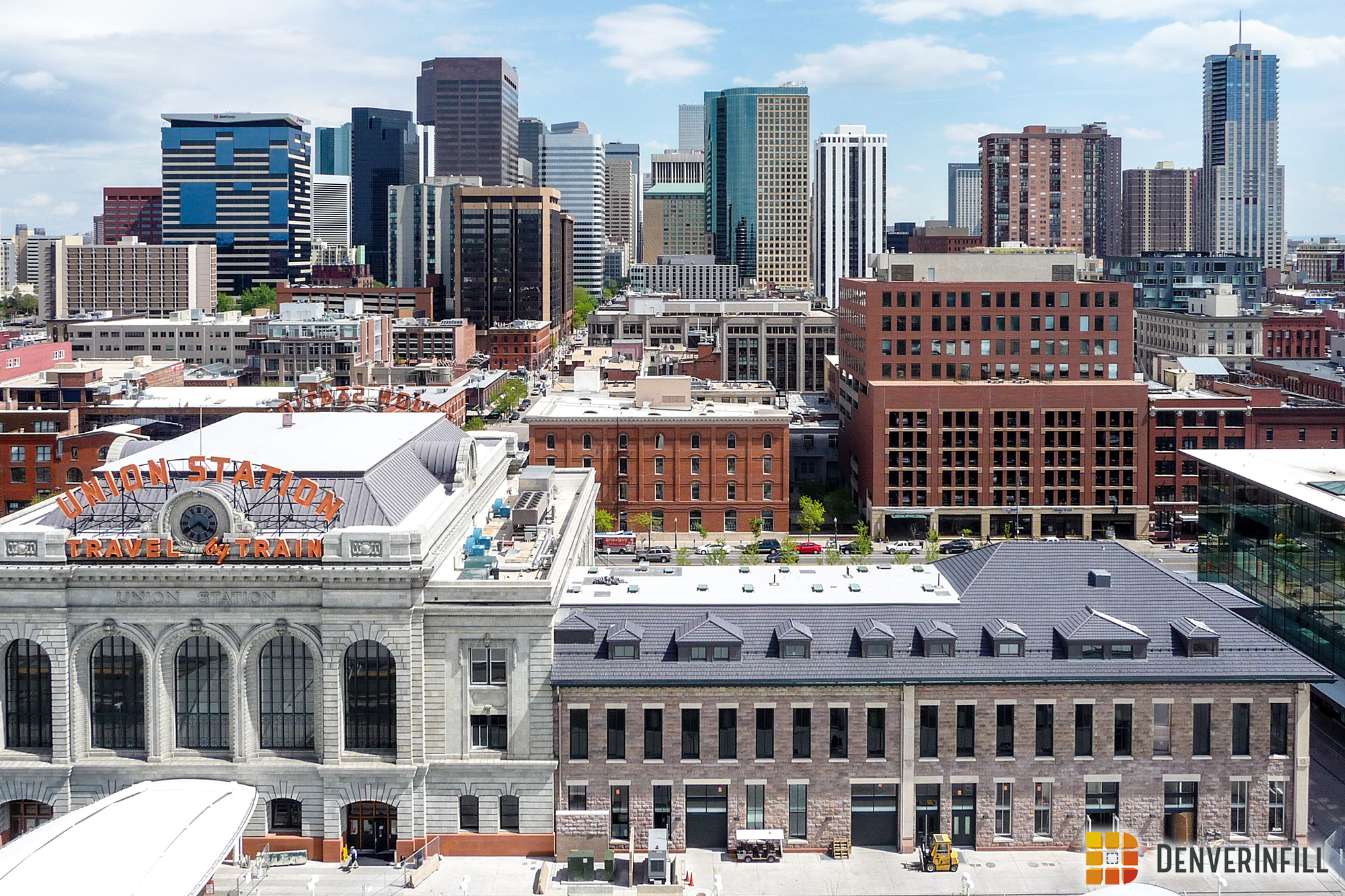
Fast forward to the recently completed 2007 Downtown Area Plan. In that document, wherever directional references are mentioned, the numbered streets Downtown are described as running east-west and the named streets as running north-south. While I was relatively involved in that planning process, I didn’t spot the error until near the end, and even though I brought it to the attention of the planning team, the final Downtown Area Plan document today still describes the Downtown grid as running counter to what Phil Goodstein states is the City of Denver’s policy on the direction that our diagonal Downtown grid officially points. The Union Station redevelopment planning process that’s currently in full swing repeats the Downtown Area Plan’s error, as it describes the Wynkoop side of Union Station as the “east” side and the Central Platte Valley side of the historic station as the “west” side.
The argument in favor of what is apparently the recently forgotten “official” position of the city on this issue is that the neighborhoods northwest of Downtown have been known for over a century as North Denver, as documented in my “Highland or Highlands?” blog and as anyone who grew up in North Denver, like my buddy Joe, knows from personal experience. If northwest Denver is “North Denver” then that means the numbered streets run north-south, not east-west, otherwise we’d refer to Highland as “West Denver.”
The argument in favor of the opposite perspective is that the numbered east-west avenues on the metro grid were originally designated to roughly align with Downtown’s numbered streets. As Denver continued to grow and the city switched the platting of streets to the more logical north-south-east-west grid, it decided to name the new east-west avenues south of Downtown in a manner that would associate them to Downtown’s numbered streets. Consequently, the avenue that ran east from the southern terminus of 17th Street was named East 17th Avenue, the avenue that ran east from the southern terminus of 16th Street was named East 16th Avenue, and so on. Following that system, the east-west avenues to the south were named in descending numerical order until the “zero” avenue was reached—Elsworth Avenue—which became the dividing line between north and south on the metro decimal street address system. Because the numbered avenues run east and west and they were associated with the numbered Downtown streets, there is some logic then in saying that the Downtown numbered streets also run east and west.
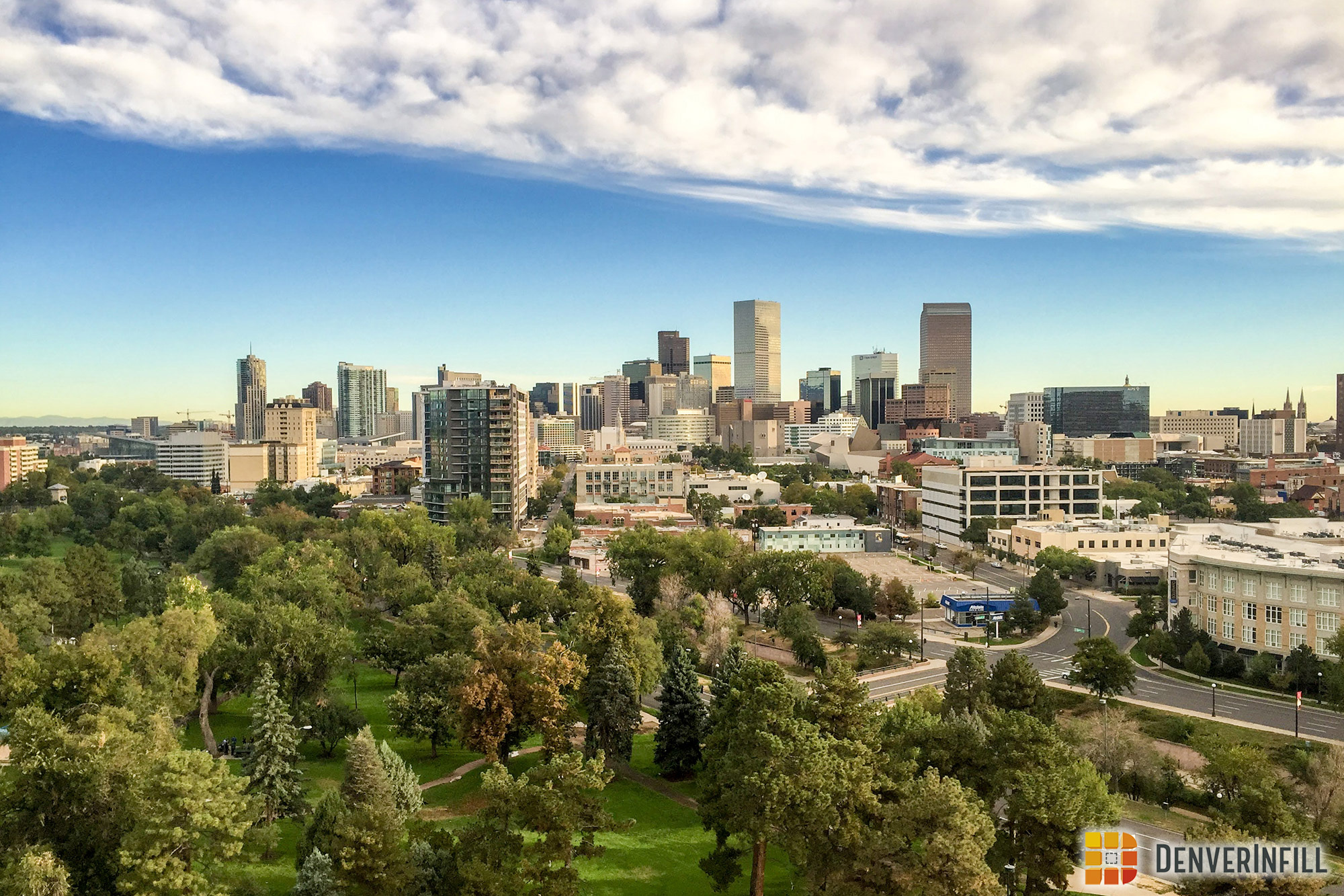
Our Downtown grid is aligned at almost a perfect 45-degree angle to the cardinal directions, not for an intentional mathematical reason, but because the Downtown streets were laid out to be parallel to Cherry Creek and the South Platte River, which just happen to intersect each other at roughly a 90-degree angle in a 45-degree rotated setting. So whether we say Lower Downtown is the “north” or “west” end of Downtown is really an even judgement call. Historical precedence points one way, recent usage points another. From my 20 years of living in Denver, it seems to me there is no consistency among locals as to a directional preference. We somehow manage to understand each other regardless, and as for the tourists and the newbies—they’re baffled by the diagonal Downtown grid anyway, so it doesn’t really matter.
After 150 years, we apparently still haven’t come to any consensus. Perhaps that’s a good thing. The confusion of direction only adds to the uniqueness and intrigue of Downtown Denver.


Wow, another meaty post… nice job. My Phil Goodstein immitation: The commemorative placards at North have references to 'North Denver', the same could be said of the other directional High Schools, and on that.. old West Denver is actually West of downtown going about South of Colfax.
I just did a Phil Goodstein tour on Saturday night, starting at Lodo's.
I think we just say the streets run north and west. The more confused visitors get, the more time they spend getting around downtown, and the more money they spend.
More good stuff Ken. Thanks!
To me, it's all about Broadway…
You come into Downtown on South Broadway and the numbered streets would be the logical progression northward into downtown (from Broadway).
Thus Civic center is South Denver and Union Station is North Denver. It's really very simple.
It's way easier to give directions following the grid off the rest of the city. Make the numbered streets east and west. It starts getting confusing when you give directions including Uptown or Cap Hill. Of course, if you're going "west" on 17th, you're also going "north" on 17th. And you're really going northwest. So it doesn't matter too much.
That said, let North Denver always be North Denver. Let it be a mystery for newbies. And leave that silly directional placque at Broadway next to the Brown Palace to be a similar mystery.
warrengfunk, Colfax is way more important than Broadway.
(Gasp!) Abomination! It is quite clear that Broadway is the true overseer of the Denver city streets (as did agree all of the Denver block number-ers way back when).
I agree with the assessment that people need not be confused with Downtown Denver's diagonal street grid. Let Civic Center be the area of 'South Denver' and let Union Station/Coors Field and Lodo be 'North Denver', letting 16th Street be a continum 'North/South Axis' for Broadway. Leave it at that.
Bah. Defend Colfax!!!!
For me, the only thing that makes sense: Numbered streets go East/West.
There are some named streets that go E/W, but there aren't any numbered streets that go North/South.
The high schools are a little confusing because North is considerably West of West…
Anyway, great article, Ken!