

We left our tour at the Oak Station site. From there, we will travel west to the end of the line at the Jefferson County Government Center Station while passing the new St. Anthony’s Hopsital and Red Rocks Community College.
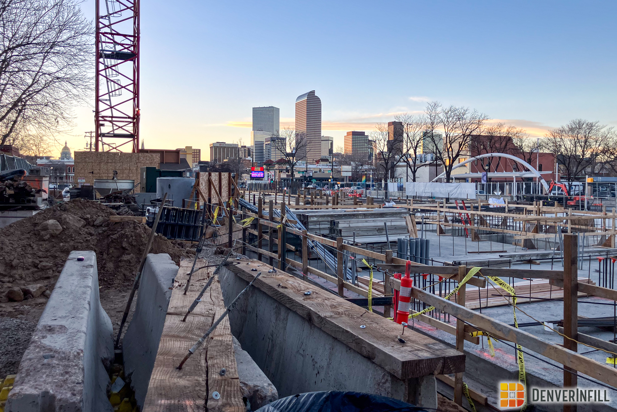
As I mentioned in the last post, initial construction activities are underway at the Oak Station site. As the guideway manuevers its way through the Lakewood Technological Park, it turns to the south as it approaches Simms Street. You can see that foundations for the catenary poles are in place and the guideway has been graded already.

The tracks will pass just to the east of the old Kacey Fine Furniture building off of the 6th Avenue frontage road. From there, the tracks will cross the 6th Avenue Bridge – the crown jewel of the West Corridor project. The massive basket-handled tied arch bridge was fully constructed at the manufacturer’s site in Oregon, then dismantled and brought to Denver. It took 34 truck shipments to deliver all the pieces of the bridge. It was then reconstructed just south of 6th Avenue and rolled across the highway on May 1. The bridge was pushed across the highway by two, eight-axled, 35′ hydraulic ram platforms. This was the first time that this type of bridge was rolled out using this method in the U.S.
The bridge has 1.2 million pounds of structural steel and nearly 55,000 high-strength structural bolts. The arches and cables will provide most of the structural support of the bridge. The bridge is 43 feet wide – wide enough for two light rail tracks – and nearly 65 feet high from the top of the arch to the bottom support beam. The weight of the tracks and ballast crossing the bridge is more than that of the structural steel in the bridge itself. The bridge support columns can support 2.7 million pounds and a sustained wind of 100 mph. There are 44 cables on the bridge, each 2 3/8″ in diameter and nearly 1,950 feet long. They have a breaking force of nearly 688,000 pounds – that’s 344 tons! The 6th Avenue Bridge uses “weathering steel” which will rust to a dark purple/brown color and form a protextive oxide coating which eliminates the need for painting now and in the future without threatening any structural integrity (this also saved RTD money). The cables will be lit by white LED lights once the bridge is complete.
The arches lean inward (hence the basket-handle name) so much so that they are 27 feet closer at the top of the bridge than at the track deck. Each arch can withstand nearly 3 million pounds of compressive force and will expand nearly 3.5 inches during extreme temperatures. The arches are supported on their own bearings by the piers on either side of 6th Avenue. There are also expansion joints at each end of the arches to facilitate temperature movements. Oddly, the shape of the arch is derived from a mathematical equation emulating the equation used to describe the force of gravity. Hopefully someone can tell me what that means – I’m a planner, not a mathematician.


Once the trains cross 6th Avenue, they will head onto former Denver Federal Center property and travel south towards the new St. Anthony’s Hospital just west of Union Boulevard at 2nd Street. The new hopsital – which is oddly Lakewood’s first – opens sometime next year. The existing Cold Springs park-n-Ride at 6th and Simms/Union will be relocated next summer to the new Federal Center park-n-Ride just north of 2nd Street across from the hospital. The site today is a vacant lot, but construction should start within the next few months.


The corridor will be single track from the Federal Center Station west to the end-of-line station at the Jefferson County Government Center, but double track from the Federal Center Station into Downtown. The Cold Springs p-n-R needs to moved to make way for a tunnel which will be constructed underneath Union Boulevard. Not much in the way of major construction can occur on the tunnel until the p-n-R moves. However, the corridor’s future path can be seen leading up to the p-n-R.

The corridor will then travel on the south side of 6th Avenue, sandwiched in between the frontage road and the highway. All of the construction work seen when you travel along 6th Avenue is the light rail guideway. The Red Rocks Community College Station has construction activity underway. Crews are forming the foundations for the shelters and the platform. There will be no parking at this station and I haven’t heard any word regarding a connection with the college. It’s a bit of a walk from the station site south to the college – hopefully something will be worked out.


There are a lot of cool machines at work along the corridor. At first glance, this one is pretty awesome – it beats post hole diggers. However, it is the without a doubt, one of the most annoyingly loud machines I have ever heard. It sounds like nails on a chalkboard as it lumbers along the highway.

If the basket-handled bridge at 6th and Simms is the crown jewel of the West Corridor, the Indiana Bridge is arguably a close second. The bridge is made of both concrete and steel and is the longest bridge on the corridor, spanning 1,531 feet. The 11-span bridge uses three independent construction frames – the first and third (those spanning the onramps) use a post-tensioned concrete box girder system while the middle span uses three steel plate girders. The center span over 6th Avenue is the longest single span in the corridor, reaching 270 feet. The tallest columns are over 40 feet high, which allows for future construction of a ramp between 6th Avenue to I-70. Like the 6th Avenue Bridge, the Indiana Bridge uses the same “weathering steel” which will rust to a dark purple/brown color. The Indiana Bridge will also have the rails attached directing to the bridge deck to make its load lighter. The bridge is only 20 feet wide, but trains will travel east and westbound intermittently. The 7.2 million pound bridge took 48,000 cubic feet of concrete and 128,000 feet of steel post-tensioning strand to complete.


The tracks will then head west on the north side of 6th Avenue and travel underneath I-70 in an already excavated tunnel. It’s hard to get a picture of the tunnel without risking life and limb, so we’ll have to settle for this view a little further out.

The trains will then cross over Colfax at 6th Avenue on a 4.6 million pound, 696 foot long, six-span bridge. The bridge has 266,000 pounds of reinforcing steel and 4.3 million pounds of concrete. The bridge will also have the tracks attached directly to the bridge deck to make the span lighter. The bridge was built without approach ramps, but those were added as construction along the corridor moved ahead. The ramp from westbound 6th Avenue to eastbound Colfax will be realigned to interface with the bridge once its complete. The bridge still carries the same design theme we saw earlier along the corridor near Wadsworth and Sheridan. There is also more construction staging occuring on this end of the corridor as well as can be seen with the concrete tie storage underneath the bridge.


The corridor will then travel just south of the Golden Cemetary at 6th and Ulysses before crossing at grade at Johnson Road into the Jefferson County Government Center complex. The tracks will pass through a hill which was located west of Johnson Road. The cut to access to JCGC complex and the future park-n-Ride is shored up by what is known as a “soil mill wall,” which uses a top-down construction method where crews excavate about five feet of soil, place tensioned support strands in the soil, pour concrete over it, then repeat the process over and over until the entire wall is complete. The cut is visible just to the left of the ramp from C-470 in the pictures below. The walls have a texture on them resembling some kind of a rocky surface. There will be a new RTD parking garage constructed just south of the existing parking at the JCGC to handle the end-of-line station. To watch the construction progress at this station, check out http://www.earthcam.com/clients/denverTransit/ for a webcam and still photos of the site.


That’s all for this West Corridor update. We’ll revisit this in the future before the corridor is open in 2013 to see how the corridor has changed. In the mean time, check out www.rtd-fastracks.com for more information on the West Corridor!


Thank you! All this certainly changes the drive down 6th!
You wrote: “Oddly, the shape of the arch is derived from a mathematical equation emulating the equation used to describe the force of gravity.”
Oddly? Since the gravitational force can be described mathematically, I do not find it odd that a bridge, effectively a structure working against gravity, can also be so described.
A good question is which curve works best in bridge design. There is no simple answer. If the arch were free standing (no deck suspended underneath it), the answer would be the “catenary curve” (invert the shape of a chain suspended at two points). Since in reality the weight of the deck far exceeds the weight of the arch, the answer is usually a “parabola” (invert the trajectory of a thrown rock). For a more detailed explanation, see
http://wapedia.mobi/en/Catenary
Thanks for the info!
I stand enlightened 🙂 Thanks!
Thanks for a nice article. I am not a fan of the rusty looks and I question the foresight of planning for a single track to Golden (hopefully all the way some day), but I can’t wait to get this line operational.
Thanks… I do enjoy these.
BTW, never one to make rash decisions, I should add that the new logo is growing, growing on me.
Thanks for the great post! I check this blog frequently, and was *so* excited to such a detailed post about the West Corridor.
Just curious, if the plan is to use Single-Track from the Federal Center to the Jeffco Govt Building, how will the passing loops work with respect to the Indiana Bridge? I thought that passing loops occur in areas where engineers can have a long line of sight for on-coming trains. With the shape of the bridge, how will they work this out? Has RTD planned where to put passing loops yet?
I (obviously) don’t know much about single-track procedures (or modern technologies used by it), so any help would be greatly appreciated. Thanks!
Thanks for the kudos Kio!
As for the passing loops, what I’m assuming is that they will occur somewhere along the 6th Avenue segment near Red Rocks – that’s the longest straightaway in that section of the corridor. I’ll look into it further though and let you know what I find.
Will passing loops even be required? My impression was that trains would run every 15 minutes and that there would be two tracks at the JeffCo gov’t center station. Accordingly, when a train arrives at the end of the line, it would park on the unoccupied track, and once it does so, the prior train would leave for the Federal Center. I can’t imagine it would take more than 15 minutes for a train to travel to and from the Federal Center and the jeffCo building.
Speaking of passing loops though, how come they’ve never been proposed on the Southeast Line? I would think 2 or 3 well placed third tracks would allow express trains to run on that line and cut down on the length of that trip. New York commuter trains through Westchester County use strategically placed third tracks, which cuts down on commute times for those living further out – as they can take an express train – and allows more trains to run on the lines. Just a thought.
Liked the summary. I’ve been wondering how the line would cross Union.
One correction: the wall at the JCGC is actually a soil NAIL wall. Each time the embankment is progressively cut in five-foot lifts, threaded steel “nails” on the order of 20 feet in length are concrete-grouted into predrilled holes at regular spacing. A subdrain is installed on the face, and the face is then pneumatically sprayed with a fine steel fiber-bearing concrete mixture (“shotcrete”). When the grout cures, the nails are post-tensioned against the wall face via a nut tightened against a little steel plate. You can see the nail heads in the picture. The nails behind the wall face effectively increase the shear strength of the soil, and prevent a slump failure (think landslide) from collapsing the cut face.